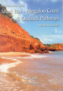
The Shark Bay – Ningaloo Cost extends 600km from north to south and the Outback Pathways cover more than 3,000km of Outback roads, all exhibiting a stunning diversity of organisms and geological and human history. More than 380 photographs illustrate the text. A satellite image is used for regional orientation and an indication of the area of study. Fourteen pages of map sections from the WA Department of Land Information StreetSmart series are included covering the coast in sequence from north to south and the Outback Pathways. There is a photographic guide with captions for the most commonly seen plants and animals.
This plastic covered, conveniently sized guide book is essential in-car for those travelling the 600 km coast from Shark Bay to Exmouth and the 3000 km of the nearby Outback Pathways. You are introduced to the geology, geomorphology, climate, human history, habitats and then given a touring guide complemented by maps, plant and animal guides and more than 380 photographs. An index, important contacts and reading list assist those wanting to delve further.
- 206 p. : col. ill., maps, ports. ; 22 cm.
- Shark Bay Region (W.A.) — Guidebooks
- Shark Bay Region (W.A.) — Description and travel
- Ningaloo Region (W.A.) — Guidebooks
- Ningaloo Region (W.A.) — Description and travel
- Murchison Region (W.A.) — Guidebooks
- Murchison Region (W.A.) — Description and travel
- Gascoyne (W.A.) — Guidebooks
- Gascoyne (W.A.) — Description and travel
#0121/170524
